Pure Liquid Fun along the Water Trail
By: Lake Tahoe Staff
By: Lake Tahoe Staff
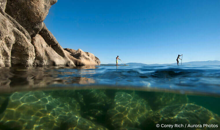
It’s time to get up close and personal with our deep blue lake on the Lake Tahoe Water Trail.
There’s a trail on the water? Actually, it’s a 72-mile water route along the shoreline with public launch/landing sites or “trailheads,” Day Trip paddle itineraries. The water trail also provides navigation tools to guide you along Lake Tahoe’s forested coastline and miles of sandy beaches.
As the only paddling source for Lake Tahoe, the Water Trail website will help you find paddle routes to match your ability and curiosity levels. They also list paddle shops and beachside gear rental options. You’ll find water safety and Tahoe Keeper aquatic invasive species prevention tips, and places to take your dog. The free Day Trip Maps include details about parking, on-site facilities and amenities, as well as public beach access to nearby hiking trails, restaurants, shopping, historic sites, lodging and campgrounds.

For the entire 72-mile route, you’ll want to buy the large, 4-color waterproof Water Trail Map & Guide. It includes underwater and land topography, latitude/longitude coordinates, GPS waypoints, and shoreline services and points of interest for Lake Tahoe and Fallen Leaf Lake to help you navigate our water world. The Map & Guide can be ordered online or found at listed locations.
Whether you’re looking for a new spot to SUP or planning to kayak around Lake Tahoe, the Lake Tahoe Water Trail has the resources to help you make the trip.
Lodging in Lake Tahoe