Must See Nevada & California State Parks In Tahoe
By: Alex Silgalis
By: Alex Silgalis
Did you know that over 78 percent of the surrounding area of Lake Tahoe is public land? This includes miles of beaches, an assortment of hiking trails, a plethora of world-class singletrack, and much more for all to enjoy. And the diamonds of the public lands crown are the Nevada State Parks and California State Parks in Lake Tahoe. Here’s a glimpse of what you’ll find within these heavenly natural oases that make Lake Tahoe so special.
Directions: Just a short five-minute walk from Heavenly Village via Heavenly Village Way will get you to the entrance of the park.
The newest Nevada & California state park has made a BIG splash in North America. Straddling both California AND Nevada, it’s the nation’s FIRST bi-state park. Within the 575 acres, you’ll find a great place to begin exploring Tahoe’s natural beauty. The miles of easy to moderate trails feature everything from pine forests to lupine meadows and even rock outcroppings to take in one of Tahoe’s famous sunsets. Not big enough? If you’re up to it, this park provides easy access to the legendary Tahoe Rim Trail which encompasses the ENTIRE length of the lake with nearly 165 miles of trail. For more about this park and what’s there to do, be sure to read our article Van Sickle Bi-State Park – A Hidden Biking, Hiking, Horseback Riding Gem That’s Right Under Your Nose.
Directions: From the casino corridor, take US-50 East into Nevada. Make a left on NV-28. About ¾ of a mile on the right you’ll see the entrance to the park. Note: There’s a $10.00 entrance fee for all vehicles ($15.00 for Non-NV vehicles.)
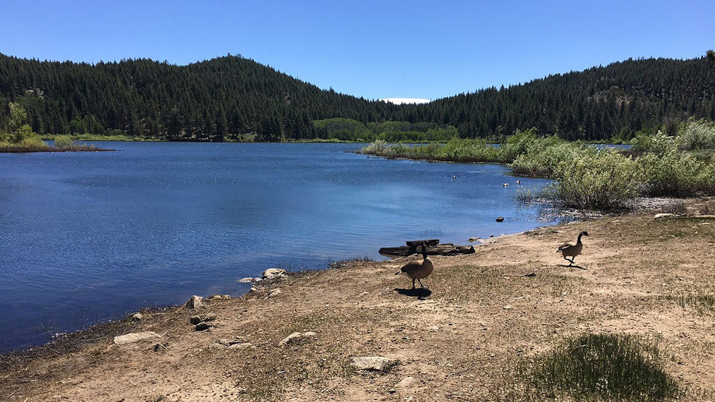
A dedicated Nevada State Park that most people fly by on their way to Sand Harbor is another great gem to explore even on the busiest days. Within its 12,000 acres, you’ll find over fifty miles of trails to explore. From a pleasant 2.5 mile stroll around Spooner Lake itself or the 5 mile moderate ascent to Marlette Lake via North Canyon Road, you’ll find the right adventure for you.
Directions: Head out on US-50 East and make a left onto NV-28 just before Spooner Summit. Just shy of 8 miles you’ll come upon the entrance on your left. Note: There’s a $10.00 entrance fee for all vehicles ($15.00 for Non-NV vehicles.)
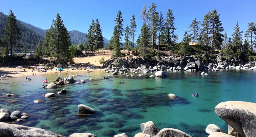
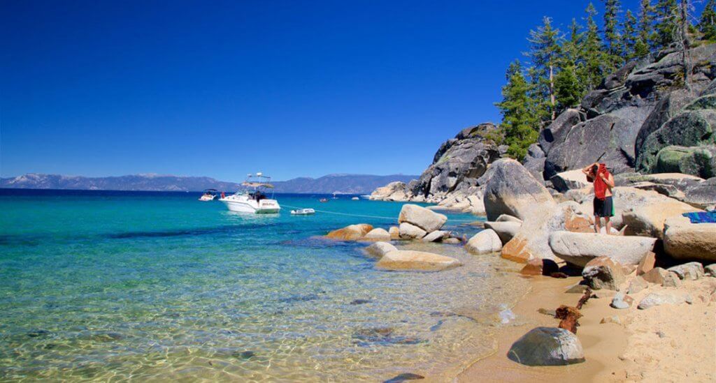
How could we talk about Nevada state parks without bringing up the famous Sand Harbor. When you see photos of people kayaking or standup paddleboarding through HUGE boulders, there’s a good chance this is where it was taken. This is also where the Lake Tahoe Shakespeare Festival is held every summer. Due to its legendary status, be aware that in the summer often times the parking lot is full by 8am or earlier. Instead of attempting to park here, we recommend heading to Incline Village and experience the new East Shore Trail dubbed as “America’s most beautiful bikeway” to get to Sand Harbor. Or better yet, visit during the shoulder seasons.
Note: There’s a $10.00 entrance fee for all vehicles ($15.00 for Non-NV vehicles.)
Directions: Follow US-50 (Lake Tahoe Boulevard) to Sawmill Road. Approximately 0.4 miles past its intersection with Sawmill Road you’ll see a gated dirt road on your left. Park nearby and walk down this dirt road.
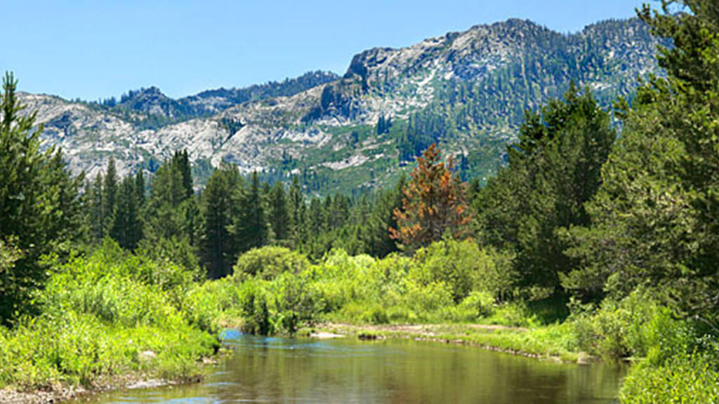
While the popular parks listed have amazing attractions to take in, if you just need to get outside and enjoy nature to its fullest, head to Washoe Meadows. Located on the outskirts of South Lake Tahoe, you’ll find an undeveloped piece of property filled with meadows and woodlands to explore without the crowds. In the spring, expect a bounty of flowers. In the winter, a snow-filled wonderland perfect for snowshoeing and cross-country skiing. And in the summer, a birding paradise. Expect to see sweeping views of the surrounding mountains such as Freel Peak, Mount Tallac, Angora Peak, and nearby Twin Peaks.
Directions: From Heavenly Village take US-50 West (Lake Tahoe Blvd) through South Lake Tahoe. Once you get to the Y make a right onto CA-89 N (Emerald Bay Rd). Follow the road for approximately nine miles. Note: Day-use parking available. Year-round parking fees at Vikingsholm parking lot.
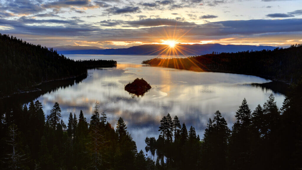
Not just a state park but a National Natural Landmark, this slice of heaven is usually what comes to mind when you think of Lake Tahoe. Within its confines you’ll find the lake’s only island, the historic estate known as Vikingsholm, and California’s first underwater maritime heritage trail. Be aware that with so much to see and do, it can get quite busy. If you do wish to see this gem, go mid-week and early in the morning or better yet, visit during the off season.
Directions: From Heavenly Village take US-50 West (Lake Tahoe Blvd) through South Lake Tahoe. Once you get to the Y make a right onto CA-89 N (Emerald Bay Rd). Follow the road for approximately 11 miles – 2 miles past Emerald Bay State Park. Note: There’s a $10.00 entrance fee for all vehicles.
Just north of Emerald Bay State Park you’ll find the D.L. Bliss State Park. Even with it being next to Emerald Bay helping catapult it to be the 2nd most popular Tahoe park, there’s a lot to see. This is where you’ll find the Rubicon Point Lighthouse. Before it was decommissioned, it was once the highest lighthouse in the United States due to Tahoe’s high elevation. On a different trail that’s perfect for families is the Balancing Rock. A huge granite boulder sits atop a smaller one looking as if at any moment it will topple over.
Directions: Continue past D.L. Bliss State Park on CA-89 N (Emerald Bay Rd) for another seven miles to the entrance of the park. Note: There’s a $10.00 entrance fee for all vehicles.
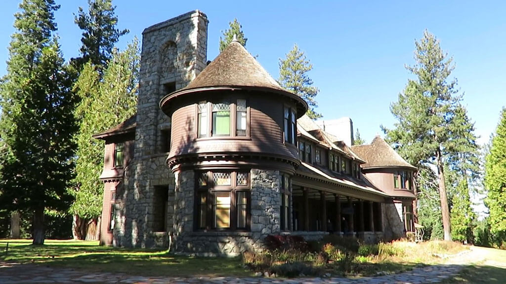
At over 2,500 acres, it’s the largest state park in the Basin and the only one that allows camping year-round. Within its confines, you’ll find trails meandering through the mixed pine forest featuring species like the Sugar Pine and Jeffrey Pines. In addition, Sugar Pine Point contains two miles of lakeshore access giving you the opportunity to take a dip in the refreshing Tahoe waters. It’s also home to the Hellman-Ehrman Mansion built in 1903. In the summer, they give tours allowing you a glimpse of how the wealthy used to summer up in Tahoe in the early 20th Century.
From seeing natural landmarks like Emerald Bay or just getting away from it all by going on a stroll in Washoe Meadows, the Nevada & California State Parks in Tahoe have A LOT to offer you. Regardless of when you visit, be sure to set aside time to explore these parks.
Check out the California State Library Parks Pass
Lodging in Lake Tahoe